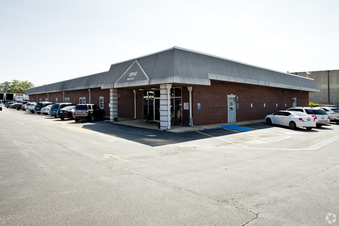
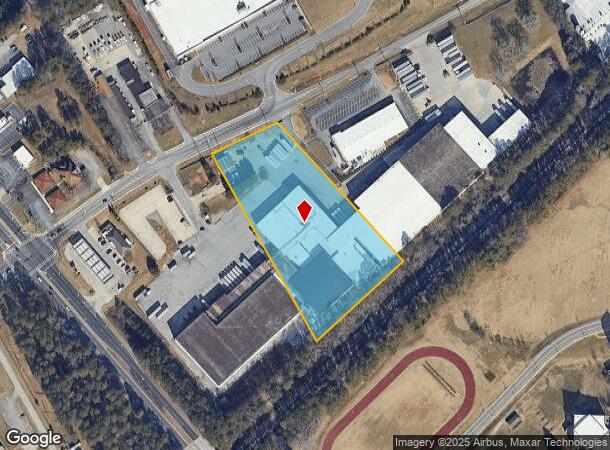
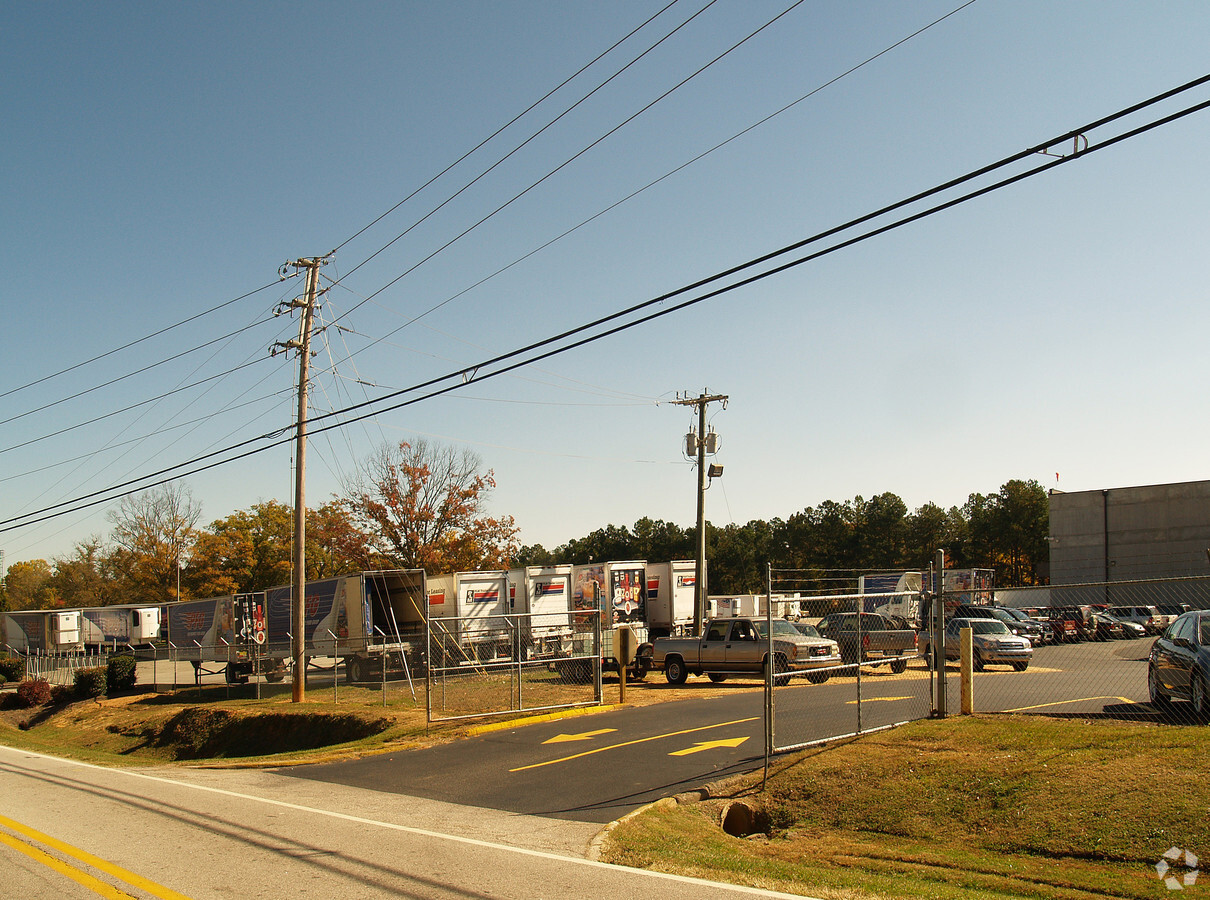
Property Record
3501 Old Oakwood Rd, Oakwood, GA 30566
NEARBY LISTINGS FOR SALE OR LEASE
Property Detail
3501 Old Oakwood Rd
Gainesville, GA
Milton Robson & Leonard Colema
08-00029-00-003D
3501 OLD OAKWOOD ROAD
Manufacturinglight
Hall
X
Georgia
13013C0025D
29
2024
5.50 AC
2024
I-985/Gainesville
001405
Atlanta
198,966 SF
DEMOGRAPHICS near 3501 Old Oakwood Rd
1 Mile
3 Mile
5 Mile
2024 Total Population
4,228
36,627
76,375
2029 Population
4,726
41,065
85,029
Pop Growth 2024-2029
+ 11.78%
+ 12.12%
+ 11.33%
Average Age
36
37
37
2024 Total Households
1,623
12,555
26,189
HH Growth 2024-2029
+ 11.71%
+ 12.16%
+ 11.36%
Median Household Inc
$65,772
$63,203
$61,977
Avg Household Size
2.50
2.80
2.80
2024 Avg HH Vehicles
2.00
2.00
2.00
Median Home Value
$227,687
$252,268
$264,383
Median Year Built
2005
1998
1995
Nearby Places
- Restaurants
- Banks
- Shops
- Fitness
- Groceries
PUBLIC TRANSPORTATION
COMMUTER RAIL
Gainesville Amtrak Station (Crescent - Amtrak)
DRIVE
WALK
Distance
Gainesville Amtrak Station (Crescent - Amtrak)
11 min
4.8 mi
Freight Ports
Georgia Ports - Savannah
DRIVE
WALK
Distance
Georgia Ports - Savannah
323 min
255.0 mi
Nearby Properties
Address
Land Use
TOTAL SIZE
Lot Size
Zoning
Address
Land Use
TOTAL SIZE
Lot Size
Zoning
150,738 SF
43.34 AC
M-1
Address
Land Use
TOTAL SIZE
Lot Size
Zoning
164,815 SF
29.93 AC
R-IV
Address
Land Use
TOTAL SIZE
Lot Size
Zoning
92,448 SF
24.25 AC
PUD
Address
Land Use
TOTAL SIZE
Lot Size
Zoning
342,720 SF
22.95 AC
PUD
Address
Land Use
TOTAL SIZE
Lot Size
Zoning
144,744 SF
35.47 AC
C-II
Address
Land Use
TOTAL SIZE
Lot Size
Zoning
4,511 SF
15.85 AC
PUD
Address
Land Use
TOTAL SIZE
Lot Size
Zoning
760,440 SF
53.33 AC
L-I
Address
Land Use
TOTAL SIZE
Lot Size
Zoning
3,881 SF
27.86 AC
R-IV
Address
Land Use
TOTAL SIZE
Lot Size
Zoning
174,720 SF
50.23 AC
M-II
Address
Land Use
TOTAL SIZE
Lot Size
Zoning
277,684 SF
23.06 AC
L-I
Address
Land Use
TOTAL SIZE
Lot Size
Zoning
157,050 SF
144.96 AC
O-I
Address
Land Use
TOTAL SIZE
Lot Size
Zoning
351,550 SF
26.91 AC
M-II
Address
Land Use
TOTAL SIZE
Lot Size
Zoning
225,378 SF
24.42 AC
M-1
Address
Land Use
TOTAL SIZE
Lot Size
Zoning
23,052 SF
6.99 AC
PRD
Address
Land Use
TOTAL SIZE
Lot Size
Zoning
132,557 SF
32.85 AC
O-I
Address
Land Use
TOTAL SIZE
Lot Size
Zoning
258,372 SF
24.38 AC
L-I
Address
Land Use
TOTAL SIZE
Lot Size
Zoning
3,195 SF
80.04 AC
AR-III
Address
Land Use
TOTAL SIZE
Lot Size
Zoning
308,672 SF
41.22 AC
L-I
Address
Land Use
TOTAL SIZE
Lot Size
Zoning
308,672 SF
41.22 AC
L-I
Address
Land Use
TOTAL SIZE
Lot Size
Zoning
201,322 SF
10 AC
M-I
Address
Land Use
TOTAL SIZE
Lot Size
Zoning
440,000 SF
15.60 AC
M-I
Address
Land Use
TOTAL SIZE
Lot Size
Zoning
41,471 SF
27.60 AC
G-B/R-II
Address
Land Use
TOTAL SIZE
Lot Size
Zoning
3,696 SF
11.89 AC
R-I
Address
Land Use
TOTAL SIZE
Lot Size
Zoning
141.54 AC
R-I
Address
Land Use
TOTAL SIZE
Lot Size
Zoning
148,068 SF
31.65 AC
M-I
Address
Land Use
TOTAL SIZE
Lot Size
Zoning
1,920 SF
10.31 AC
H-B
Address
Land Use
TOTAL SIZE
Lot Size
Zoning
16,560 SF
9.62 AC
PRD
Address
Land Use
TOTAL SIZE
Lot Size
Zoning
45,986 SF
28.83 AC
H-B
Address
Land Use
TOTAL SIZE
Lot Size
Zoning
102,996 SF
10.94 AC
L-I
Address
Land Use
TOTAL SIZE
Lot Size
Zoning
287,366 SF
61.55 AC
I-II
The World's #1 Commercial Real Estate Marketplace
Connect with us
© 2025 CoStar Group
The information above has been obtained from sources believed reliable. While we do not doubt its accuracy we have not verified it and make no guarantee, warranty or representation about it. It is your responsibility to independently confirm its accuracy and completeness. Any projections, opinions, assumptions, or estimates used are for example only and do not represent the current or future performance of the property. The value of this transaction to you depends on tax and other factors which should be evaluated by your tax, financial, and legal advisors. You and your advisors should conduct a careful, independent investigation of the property to determine to your satisfaction the suitability of the property for your needs.